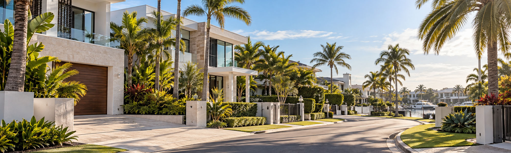
From the air, the Gold Coast reveals a landscape unlike almost anywhere else in Australia. Behind its famous beaches and towers, an extraordinary network of canals winds between residential neighbourhoods, connecting thousands of waterfront properties to rivers, lakes and the Broadwater. These waterways have become such a familiar part of the city that it is easy to forget how recently much of this landscape was created.
Only a few generations ago, large sections of what are now Broadbeach Waters, Mermaid Waters and other canal-front suburbs were low-lying grazing properties, tidal flats, wetlands and winding natural creeks. The intricate network of residential islands, waterfront streets and navigable channels that exists today was largely the result of an ambitious development movement that gathered momentum during the 1950s.
Inspired by waterfront communities in Florida, property developers and town planners recognised that the Gold Coast possessed the ingredients for an entirely different kind of Australian suburb. By excavating canals and using the material to raise adjoining land, they could create residential allotments with direct water frontage, transforming the commercial value of land that had previously been difficult to develop.
The result changed the Gold Coast permanently. Canal estates helped establish a distinctive waterfront lifestyle, influenced residential architecture, created new property markets and transformed the physical geography of the city. Their history is also a story of extraordinary engineering, entrepreneurial ambition and the environmental consequences of reshaping a coastal landscape.
Before the Canals: A Landscape of Rivers, Wetlands and Tidal Creeks
Long before the first residential canal was excavated, the Gold Coast was defined by its natural waterways. The Nerang River, Coomera River, Tallebudgera Creek, Currumbin Creek and their tributaries flowed through a landscape of coastal plains, estuaries, mangroves, wetlands and sandy islands. Waterways shifted naturally over time as tides, storms, flooding and sediment movement altered the coastal environment.
These waterways were part of the traditional lands and waters of Aboriginal peoples, including the Kombumerri people of the Yugambeh language region. The estuaries, coastal forests and adjoining beaches provided important sources of food and formed part of a cultural landscape occupied and cared for over countless generations. Archaeological evidence around Broadbeach, including shell middens and the well-known Broadbeach burial ground, demonstrates the area's long Aboriginal history.
European settlement brought substantial changes during the nineteenth century. Timber getting, farming, cattle grazing and the establishment of small settlements gradually altered the landscape. The Nerang River provided a means of transporting timber, while the coastal lowlands supported agricultural activities where conditions permitted.
Even as Southport, Surfers Paradise and other seaside settlements developed, considerable areas immediately inland remained sparsely populated. Seasonal flooding, tidal influences and saturated ground complicated conventional residential subdivision. Land close to the beach could be commercially attractive, but its physical characteristics often made development expensive.
The coastline itself was also changing. The mouth of the Nerang River historically migrated northward as sand moved along the coast. The Gold Coast Waterways Authority records that the river entrance was situated much farther south in earlier centuries, before gradually shifting towards the northern end of the Southport Spit.
By the middle of the twentieth century, developers were beginning to view these natural constraints as opportunities. Land that required drainage, filling or substantial alteration could potentially be transformed into valuable residential waterfronts if suitable engineering methods and commercial finance were available.
The American Inspiration Behind the Gold Coast's Canal Estates
The modern Gold Coast canal estate owes much of its inspiration to Florida in the United States, particularly the waterfront residential developments around Miami and Fort Lauderdale.
During the early twentieth century, Florida developers had demonstrated how low-lying coastal land could be transformed into planned residential communities. Artificial waterways extended through reclaimed land, providing numerous properties with private access to navigable water. Houses could be built alongside canals, allowing residents to enjoy waterfront outlooks and keep boats close to home.
For Australian developers seeking new opportunities during the postwar economic expansion, the concept was particularly attractive. The Gold Coast possessed an appealing climate, extensive natural waterways and a rapidly growing reputation as a holiday destination. Its coastal geography offered similarities to parts of Florida, while its proximity to Brisbane provided access to an expanding market of prospective buyers.
One of the most influential figures was Brisbane real estate entrepreneur Alfred Grant, who was familiar with American waterfront developments. Grant recognised the potential for canal-based residential communities on the Gold Coast and worked with architect and town planner Karl Langer to develop the concept.
Langer, an Austrian-born architect who had established his career in Queensland, brought a broader planning perspective to the projects. His approach drew on international planning ideas, including Dutch land reclamation practices and the Radburn principles of residential layout. In the canal estates, waterways could serve as the open spaces and rear outlooks around which residential allotments were arranged.
The resulting developments combined imported ideas with local engineering and property-market conditions. The canals provided water access, but their arrangement also determined street patterns, allotment shapes, subdivision density and the character of entire neighbourhoods.
The influence of Florida remains visible in the names of early developments. Miami Keys, Rio Vista and Florida Gardens reflected the American associations that helped market a new style of coastal residential living to Australian buyers.
Florida Gardens: One of the Gold Coast's Earliest Waterfront Developments
Florida Gardens, now part of Broadbeach Waters, was among the pioneering developments that established the Gold Coast's canal-estate movement.
Planning began in February 1956 on land west of Cascade Gardens, near the junction of Little Tallebudgera Creek and the Nerang River. The property had previously been associated with dairy farming and was characterised by low-lying terrain that required substantial preparation before residential construction could proceed.
The development was undertaken by Savoy Hotels Ltd with approval from the Albert Shire Council. According to historical records preserved by Gold Coast City Libraries, the original scheme involved approximately 200 acres of reclaimed land, with plans incorporating around 1,000 residential allotments and areas of parkland.
At the time, Florida Gardens was described as the largest land development project in Queensland. The reported cost of sand pumping to raise the land was £178,000, a substantial investment that demonstrates the scale of work required before the properties could be sold and occupied.
The first residential allotment was sold in 1957. During August of that year, a bridge across Little Tallebudgera Creek was opened to connect the development with the Pacific Highway via Monaco Street. The bridge was designed by engineering consultants Cardno and Davies, who were also involved in the wider development project.
Albert Shire Council engineer Tom E Peters played an important role in overseeing the works. His contribution is remembered through T E Peters Drive, which remains a prominent road through Broadbeach Waters.
Florida Gardens developed progressively rather than emerging as one completed neighbourhood. By 1960, Savoy Hotels had sold the second stage to Lois and Barry Cleland, who operated through Diamond Head Pty Ltd. The Clelands continued preparing land in stages, raising individual sections before releasing them for sale.
Historical accounts record that material excavated from high-rise construction sites in Surfers Paradise and from the future Oasis Shopping Centre site in Broadbeach was used as fill. The practice demonstrates how the construction of the growing tourist centre and the development of surrounding residential land became physically connected.
In 1966, the Clelands dredged their first canal. Lois Cleland subsequently acquired Barry's interest in the Diamond Head companies in 1974 and continued as a developer in her own right.
Florida Gardens provides an important reminder that the emergence of the canal suburbs was a gradual process. Planning, filling, road construction, sales and canal excavation often occurred over many years, with different stages reflecting changing developers, market conditions and engineering approaches.
Miami Keys and Rio Vista: The Arrival of Purpose-Planned Canal Living
While Florida Gardens helped establish the commercial and engineering foundations of waterfront subdivision, Miami Keys and Rio Vista brought the purpose-designed canal estate into sharper focus.
Developed through the work of Alfred Grant and Karl Langer during the late 1950s, these projects drew particularly strongly on the finger-island layouts associated with Fort Lauderdale. Their planning sought to maximise the number of residential properties with direct canal frontage.
The basic arrangement was ingenious. A series of elongated residential peninsulas or islands could be separated by artificial channels, with roads providing land access and canals occupying the spaces behind the houses. Residential allotments were arranged so that their rear boundaries met the water.
For developers, the layout offered a way to create numerous waterfront properties within a relatively compact subdivision. For purchasers, it introduced a form of residential living previously associated with exclusive riverfront or beachfront sites.
These estates helped establish the visual character that would later become associated with Broadbeach Waters and Mermaid Waters: long canal frontages, residential streets following geometric patterns, and houses orientated towards the water behind them.
The design also altered the relationship between houses and their surroundings. Conventional suburban properties generally presented their principal garden or outdoor living area towards the street or rear yard. In a canal estate, the water became a principal feature of the property, influencing living-room outlooks, garden design and eventually the arrangement of outdoor entertainment areas.
The commercial importance of this shift was considerable. Developers had found a way to manufacture waterfront frontage, creating a new category of residential land in a market where proximity to water was already highly desirable.
The Canals Act 1958: A New Legal Framework for Waterfront Development
The rapid emergence of canal subdivisions raised legal and administrative questions that conventional land-development arrangements had not fully anticipated.
Artificial canals involved the excavation of waterways through privately developed land, connections to tidal systems, questions of ownership and the continuing management of infrastructure adjoining residential allotments. These matters required a clearer statutory framework.
Queensland responded with the Canals Act 1958, legislation that became an important milestone in the development of the Gold Coast's waterfront estates.
Notably, the legislation followed the commencement of some pioneering projects. Section 13 expressly identified Florida Gardens, Miami Keys, Rio Vista and Moana in its provisions dealing with canals that had already been proposed or approved under earlier arrangements.
This provides valuable historical evidence of how quickly canal development had progressed during the second half of the 1950s. The projects were sufficiently advanced to require specific recognition when the new legislation was introduced.
The Act helped establish a framework within which further canal development could proceed. As the industry expanded, legislation, planning requirements and engineering standards continued to evolve in response to the distinctive issues associated with artificial tidal waterways and waterfront residential land.
The Great Expansion of Canal Estates During the 1960s and 1970s
With the earliest canal estates demonstrating commercial potential, the concept spread rapidly through the Gold Coast's coastal lowlands.
During the 1960s and 1970s, residential development progressively transformed land west of the established beachside settlements. Developers excavated new channels, created artificial peninsulas and extended streets into areas that had previously been used for grazing or remained relatively undeveloped.
Broadbeach Waters became one of the clearest examples of this transformation. Its present-day pattern of waterways, islands and residential streets reflects numerous stages of subdivision rather than a single comprehensive construction project. Florida Gardens, Rio Vista, Rialto and adjoining estates contributed to the broader neighbourhood that eventually became familiar under the Broadbeach Waters name.
Mermaid Waters developed through a similar process, with extensive canal construction creating residential neighbourhoods behind Mermaid Beach. The layouts included long waterways and narrower channels, providing a mixture of waterfront allotments and conventional residential streets.
Further north, developers pursued opportunities along the Nerang River and around Surfers Paradise. The Isle of Capri became associated with Bruce Small's ambitious Paradise City development, a project that promoted the Gold Coast as a modern resort and residential destination.
Small, who had established his reputation through the Malvern Star bicycle business, became one of the most recognisable figures in the Gold Coast's postwar development. His promotional activities, property interests and subsequent involvement in local politics reflected the close relationship between private development and the rapidly expanding city.
The Isle of Capri and nearby Sorrento developed distinctive combinations of natural river frontage and artificial waterways. Their residential streets and canal arrangements created opportunities for waterfront living close to the commercial centre of Surfers Paradise.
Other developments progressively extended the canal lifestyle through parts of Benowa, Bundall and the northern Gold Coast. The scale and character of individual estates varied, but the underlying commercial principle remained consistent: carefully planned waterways could create residential frontage with a value that exceeded that of comparable inland allotments.
By the end of the 1970s, canals had become one of the defining elements of the Gold Coast's urban form, influencing where residential growth occurred and how large parts of the city were arranged.
How the Gold Coast's Canals Were Built
The construction of a canal estate involved much more than digging a channel through vacant land. Developers first needed to establish the levels, boundaries and proposed layout of the future subdivision, taking account of the surrounding waterways and the conditions of the site.
Many of the early development areas were low-lying and required extensive filling before houses and roads could be constructed. Sand pumping and dredging became particularly important because excavation could create the required water channels while supplying material to raise adjacent residential land.
In a typical canal-estate development, dredging equipment removed sand and other suitable material from the proposed waterway. The excavated material could then be deposited across adjoining areas, gradually forming higher residential platforms. This allowed the creation of canals and building land to proceed as related parts of the same operation.
The process was particularly effective where suitable sandy material was available, although actual construction methods depended on local ground conditions, the design of the estate and the engineering practices of the period.
Developers also needed to provide road access, bridges, drainage connections and canal-edge protection. In subdivisions incorporating finger islands, the relationship between roads and waterways had to be resolved before individual allotments could be finalised.
Canal depths and widths were important considerations. A navigable waterway needed to accommodate the types of boats likely to use it while allowing for tides, sediment accumulation and connections to the wider river system.
The finished neighbourhood often looked dramatically different from the land that had existed only a few years earlier. Former grazing paddocks and wetlands became residential streets surrounded by water, with the new canals providing both a visual setting and a practical connection to the Gold Coast's boating network.
The engineering achievement was substantial, particularly when considered in the context of the equipment and development practices available during the 1950s and 1960s. Much of the waterfront landscape now regarded as an established part of the city was created through these successive excavation and land-forming projects.
Paradise Point and the Northern Expansion of Waterfront Living
As the canal-estate concept gained popularity, development extended into northern districts where the Broadwater, Coomera River and adjoining creeks provided an appealing setting for residential growth.
Paradise Point had begun developing as a residential settlement before the canal-estate boom. Its first subdivision release occurred in April 1953, with waterfront allotments promoted alongside parks, a shopping centre and the protected waters of the Broadwater.
The initial development was sufficiently popular that all 122 allotments offered in the first release sold within two weeks. This early success demonstrated the attraction of residential land close to the Broadwater, even before artificial canals became a major feature of the district.
By 1970, canal-front land was being marketed in the Paradise Point Keys development west of the Broadwater. Historical records indicate that the first stage comprised 135 waterfront allotments and sold out within approximately a year.
A second stage associated with Lewis Land was advertised in late 1971. Canal-front blocks in the development were promoted from $6,950, a figure that illustrates how waterfront land was marketed during an important period of Gold Coast expansion.
Later residential projects continued to transform the northern waterfront landscape. Sovereign Islands emerged through the redevelopment of islands historically associated with Paradise Point, while Ephraim Island became a prestige residential development with direct access to the Broadwater.
The waterways of the northern Gold Coast consequently developed a different character from some of the earlier central canal estates. Broadwater exposure, connections to larger river systems and the presence of island developments helped shape the residential environment.
These differences remain important to the character of individual waterfront neighbourhoods. Canal width, outlook, access to open water and proximity to the Broadwater all contribute to the variety of waterfront properties found across the city.
From Holiday Homes to Prestige Waterfront Properties
The earliest canal estates emerged during a period when the Gold Coast was still developing its identity as a major residential city. Many purchasers were attracted by the prospect of a holiday property, a retirement home or a relatively modest residence with the unusual benefit of water frontage.
Typical residential architecture of the period was considerably different from the large contemporary houses now associated with many waterfront streets. Postwar fibro, timber and brick homes, often single-storey, occupied allotments that would later become highly desirable redevelopment sites.
For many households, the canal itself was the principal attraction. A modest house could offer views across the water, an outdoor living area overlooking passing boats and the possibility of keeping a small recreational vessel nearby.
As the Gold Coast grew and household expectations changed, the waterfront housing market evolved. During the 1970s and 1980s, larger brick homes and more substantial two-storey residences became common in many established canal neighbourhoods.
Outdoor living increasingly influenced home design. Covered terraces, swimming pools and landscaped gardens were arranged to take advantage of waterfront outlooks. Living rooms, kitchens and principal bedrooms were often positioned towards the canal rather than the street.
By the 1990s and 2000s, substantial redevelopment was occurring in sought-after waterfront areas. Older houses were renovated, extended or replaced with contemporary residences designed around open-plan living and expansive views.
This process has continued as the city has matured. In many canal-front streets, houses from several different decades stand alongside one another, illustrating successive periods of Gold Coast residential architecture.
Original postwar homes, substantial late-twentieth-century residences and newly constructed prestige properties can sometimes be found within the same neighbourhood. Their coexistence reveals how the value attributed to waterfront land has changed since the first estates were sold.
How the Canals Changed Gold Coast Property Values
The creation of residential canals introduced an important distinction into the Gold Coast property market: the difference between land near the water and land with direct private water frontage.
Before artificial canal development, opportunities to own a residential property adjoining navigable water were largely confined to natural riverfronts, creek frontages and parts of the Broadwater. The number and location of these properties were determined by existing geography.
Canal construction greatly expanded the supply of waterfront allotments, allowing developers to establish new residential precincts where water access could become a principal selling feature.
Over time, the appeal of canal frontage became increasingly sophisticated. Buyers began distinguishing between properties according to waterway width, orientation, privacy, outlook, proximity to open water and the nature of boating access.
Wide-water properties often developed particular appeal because of their expansive outlooks, while some narrower canals offered more sheltered residential settings. Main river frontage and properties with comparatively direct access to the Broadwater also occupied distinctive positions within the waterfront market.
The relationship between land and buildings changed accordingly. In desirable locations, the value of the waterfront allotment itself could become a major consideration, encouraging the replacement of older houses with more substantial contemporary residences.
For the Gold Coast, this was one of the most significant long-term consequences of canal development. Artificial waterways created an enduring property category with its own market characteristics, architectural trends and patterns of redevelopment.
The historic canal layouts continue to influence residential values because they determine the water frontage available to individual properties. Canal geometry, road arrangements and allotment configurations established decades ago remain fundamental features of the modern property market.
The Environmental Consequences of Transforming the Coast
The creation of the Gold Coast's canal system also brought substantial environmental changes.
Many residential developments occupied land that had previously supported wetlands, tidal vegetation, natural drainage systems and other coastal habitats. Excavation and filling altered the relationship between the land and surrounding waterways, while the introduction of artificial channels changed local patterns of water movement.
The environmental implications of these developments were not always assessed according to the standards that would apply to major waterfront projects today. Planning practices, scientific understanding and environmental regulation evolved considerably during the decades in which the canal system expanded.
Artificial waterways create different conditions from natural rivers and creeks. Their geometry, depth and connections to tidal systems influence how water circulates and how sediment moves. Narrow channels and enclosed canal ends can experience different water-quality conditions from open rivers or the Broadwater.
Urban development surrounding the canals also influences water quality. Stormwater carries sediment and other materials from roads, gardens and built surfaces into the drainage network, making the management of runoff an important part of protecting the waterways.
The loss or modification of natural wetland environments is another part of the historical legacy. Mangroves and tidal habitats perform important ecological functions, providing shelter and feeding grounds for aquatic species while contributing to the wider health of estuarine systems.
These considerations have increasingly shaped the way waterfront development and waterway management are approached. Environmental assessment, water-quality monitoring, sediment management and the protection of significant habitats now play a more substantial role than they did during the earliest canal-estate developments.
The canal network is therefore both a defining residential asset and an engineered environment that requires continuing attention. Its history illustrates the substantial influence that urban development can exert on a coastal ecosystem over successive generations.
Flooding and the Changing Approach to Canal Development
Waterfront subdivision also raised questions about flooding from the earliest years of canal construction.
Much of the land selected for development was naturally low-lying and associated with rivers, creeks and coastal floodplains. Raising residential allotments provided one response to these conditions, but the wider movement of floodwater through the landscape remained an important planning consideration.
As canal estates expanded, engineers and public authorities undertook further investigations into regional drainage and flooding behaviour. The relationship between artificial waterways, surrounding development and natural flood paths became an increasingly significant part of urban planning.
The Benowa Flood By-Pass Canal, completed in 1980, was one response to flooding concerns within the wider Nerang River catchment. Its purpose was different from that of a residential canal estate, demonstrating that artificial waterways on the Gold Coast have served several distinct functions.
Residential canals were primarily designed around subdivision and waterfront access. Flood-management channels were developed to help convey water through particular parts of the drainage system. Both became components of the altered urban landscape, but their engineering objectives were different.
Modern flood assessment involves more extensive modelling of rainfall, river flows, storm tides and other influences than was available to early developers. The historic transformation of low-lying land remains relevant to understanding the drainage characteristics of established waterfront suburbs.
The Gold Coast Seaway and the Transformation of Marine Access
Although the construction of the Gold Coast Seaway was separate from the development of residential canal estates, it became one of the most important infrastructure projects in the history of the city's waterways.
For much of the Gold Coast's history, the entrance to the Nerang River and Broadwater was affected by the natural movement of sand along the coastline. The Southport Bar was notorious for its changing conditions, with shifting sandbanks and waves creating hazards for vessels entering or leaving the ocean.
By the late twentieth century, the growth of recreational boating and marine industries strengthened the case for a more stable entrance. Following extensive investigation and planning, the Queensland Government commenced the Nerang River Entrance Stabilisation Scheme in 1983.
The project involved constructing substantial rock breakwaters, excavating a new navigation entrance and establishing an innovative system to transfer sand across the channel.
The Gold Coast Seaway opened in 1986. Its construction involved approximately one million tonnes of imported rock and the dredging of around 4.5 million cubic metres of sand, according to the Gold Coast Waterways Authority.
One of its most remarkable features was the permanent sand bypass system. Designed to address the natural northward movement of sand, the system pumps material collected south of the entrance through a pipeline to South Stradbroke Island.
The arrangement was pioneering at the time and helped establish a more reliable connection between the Broadwater and the Pacific Ocean. Wave Break Island was also created as part of the broader project to help protect areas of the Broadwater from wave action.
For the city's waterfront communities, the Seaway strengthened the connection between the extensive inland boating network and offshore waters. It supported the expansion of marine recreation and related industries, adding another dimension to the lifestyle associated with canal-front property.
The Seaway also demonstrated an important reality about the Gold Coast's engineered waterways: major infrastructure requires ongoing management. Sand continues to move naturally along the coastline, making the operation and maintenance of the bypass system an enduring part of the city's coastal management.
A Waterfront City That Requires Constant Management
The Gold Coast's canal network is sometimes described as one of the most extensive systems of artificial residential waterways in the world. Whatever measurement is used to describe its overall length, the scale of the network is striking when viewed from above.
The canals connect with a wider system of rivers, creeks, lakes and the Broadwater, creating a complex environment used by residents, recreational boaters, commercial operators and visitors.
Maintaining access through these waterways involves managing navigation channels, sediment movement and changing environmental conditions. Some parts of the network experience ongoing sediment deposition as currents, tides and storm events redistribute material.
Dredging remains an important management activity. The Gold Coast Waterways Authority undertakes dredging programs to maintain navigable channels, with environmental assessments and regulatory requirements forming part of the process.
Waterway management also extends beyond navigation. Water quality, marine habitat, boating safety and the interaction between public waterways and adjoining residential development all require consideration.
The establishment of the Gold Coast Waterways Authority under Queensland legislation in 2012 provided a dedicated statutory body for managing and planning the city's waterways. Its responsibilities reflect the importance of the network to the wider economy, environment and community.
What began as a series of private development projects has consequently become a substantial and interconnected public waterway system. Its maintenance and long-term management are now significant responsibilities extending well beyond the boundaries of the original estates.
Reading the History of the Canals Through Today's Suburbs
One of the most fascinating aspects of the Gold Coast's canal history is how clearly the development of different eras remains visible in the present-day suburbs.
Broadbeach Waters contains some of the earliest examples of planned waterfront subdivision. The arrangement of Florida Gardens and neighbouring canal estates reflects the progressive development of the area from the 1950s onward, with later stages extending the system and connecting previously separate neighbourhoods.
Mermaid Waters illustrates the larger-scale adoption of the canal-estate concept as residential growth moved farther south. Its network of channels and residential streets forms an extensive planned landscape behind the established beachside strip.
The Isle of Capri and Sorrento demonstrate a different relationship between artificial waterways, natural river frontage and residential development. Their proximity to Surfers Paradise and the Nerang River has influenced both their original layout and subsequent architectural evolution.
In the northern Gold Coast, Paradise Point, Runaway Bay and adjoining waterfront communities reflect the expansion of residential boating culture around the Broadwater. Later island developments introduced further variations on the relationship between residential property and surrounding water.
Even within individual suburbs, differences in canal width, allotment configuration and street arrangement frequently reveal the boundaries between historical stages of development. An aerial photograph can provide clues about the planning principles, construction methods and commercial priorities that shaped a particular neighbourhood.
The architecture offers another record of change. A modest postwar house on a valuable waterfront allotment may stand beside a contemporary residence designed around panoramic water views. Together, they illustrate how a suburb's physical layout can remain relatively constant while its housing stock undergoes substantial transformation.
The Lasting Legacy of the Gold Coast's Canal Builders
The developers, engineers and planners responsible for the Gold Coast's canal estates helped create one of Australia's most distinctive urban landscapes.
Their achievements extended beyond the excavation of waterways. They established patterns of subdivision that influenced the direction of suburban growth, changed expectations about coastal residential living and created a property market in which direct water frontage became a defining feature.
Alfred Grant and Karl Langer helped introduce and adapt the canal-estate concept. The developers of Florida Gardens demonstrated how large areas of low-lying land could be progressively transformed. Figures such as Lois Cleland continued expanding these neighbourhoods, while Bruce Small and other entrepreneurs promoted the wider vision of the Gold Coast as a modern waterfront destination.
The success of these projects encouraged further investment and residential growth. Over time, the development movement influenced not only the Gold Coast but also canal-based communities elsewhere in Australia.
Its legacy, however, extends beyond commercial success. The replacement of wetlands and natural landscapes, the alteration of coastal drainage and the continuing management needs of artificial waterways remain inseparable from the history of the estates.
Today, the Gold Coast's canals support established residential communities, a substantial recreational boating culture and a distinctive waterfront property market. Their layouts continue to determine the shape of streets, the outlooks from homes and the opportunities for redevelopment.
The canals are so deeply integrated into the modern Gold Coast that they can appear to be natural elements of its geography. Yet much of this waterfront city was deliberately planned, excavated and constructed within living memory. Its history reveals how an ambitious idea borrowed from overseas became a defining feature of Queensland's most recognisable coastal city.
You might also like


Disclaimer: Every effort has been made to ensure the accuracy of the information provided, but we make no guarantees regarding its completeness or reliability. The data is presented for general informational purposes only and does not constitute financial, investment, or legal advice. We are not liable for any errors, omissions, or consequences arising from its use. Users should verify details with relevant sources and seek professional advice where appropriate for the most accurate and up-to-date guidance.


